- Expeditions
By Region
By Month
By Grade
By Height
- Treks
By Region
By Month
By Grade
By Height
- UK & Alpine
By Category
By Grade
- Schools
- Hire
- News
- Shop
Clothing
Footwear
Equipment
Expedition

- Contact


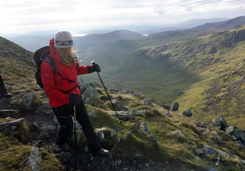
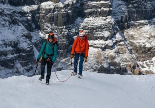
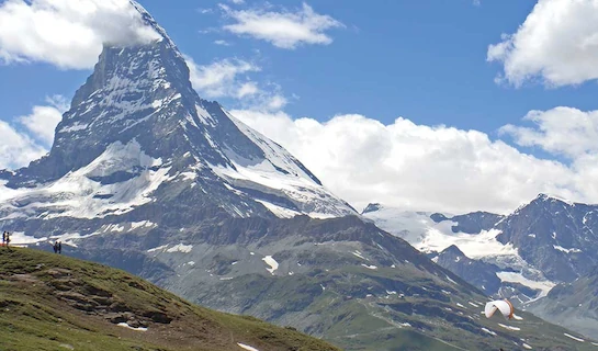
Walkers Haute Route
From £2,895 Altitude 2,965m Grade: T3
Walkers Haute Route
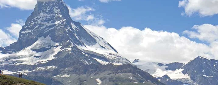
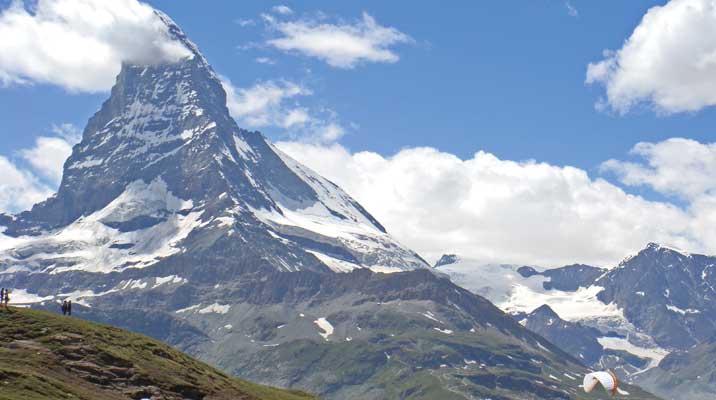
An Alpine classic from Chamonix to Zermatt crossing eleven high passes
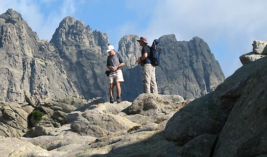
This exciting route, connecting two world-renowned mountaineering centres, takes the walker through the most spectacular scenery the Alps has to offer, passing numerous 4000m peaks but itself never quite rising above 3000m. Measuring over 180km, and with at least eleven high passes to cross it weaves its way across the 'grain' of the land between the Rhone Valley to the north and the spine of the Alps to the south. You will pass through remote hamlets, spectacular valleys, flower-filled alps and deep forests, staying overnight in a variety of dormitories, refuges and hotels.
You need to carry a light backpack on this trip, and have a good degree of fitness to tackle over 10,000m of ascent and descent on this trip.
Dates & Prices
Availability
* A deposit of £300 will be required at checkout.
** Flight prices are estimated and will be confirmed prior to final payment.
Payment Schedule:
Initial Deposit as quoted above upon booking
Interim Deposit £300, due 4 months before departure
Final Balance due 10 weeks before departure
Extras
Extras can be added per-person when you book onto a date
| Item | Price | Days | |
|---|---|---|---|
| Breithorn Extension | £295 | +1 days | |
| Walkers Haute Route Single Supplement 9 Nights | £980 |
* A deposit for any optional extras selected will be required at checkout, with the amount depending on the extras chosen.
What's Included
- International flights and taxes (flight inclusive package)
- Accommodation - 13 nights staying in hotels / gites / refuges
- Meals - 14 breakfasts, 11 evening meals
- Baggage Transfers
- Park fees as appropriate
- Qualified International Mountain Leader
- All team members will receive a free logoed gift (for clients residing outside of the UK a postage charge will be applied)
- 24hr back-up and support from our UK staff
- 15% discount off the RRP on equipment and clothing purchased from the Adventure Peaks shop
What's Excluded
- Travel to and from UK airport
- Airport transfers to Chamonix and Zermat to airport
- Travel Insurance
- Meals if not indicated in 'Inclusions'
- Any uplift or other transport costs if used as an option to shorten any days
- Personal equipment
- Drinks and personal spending
- Tips for local staff
- Visas (if required)
Itinerary
Day 1 | Fly to Geneva and travel to Argentiere by train / bus or private shuttle. If you are able to get to Chamonix by early afternoon, you may like to walk to Argentiere which is a very easy to follow 2-hour stroll along the valley - thus taking the opportunity to be a purist and complete the route from its official start point! Rendezvous with the leader and the rest of the group at the accommodation in Argentiere in the early evening.9km, +214m, 2 hours (optional) walking. |
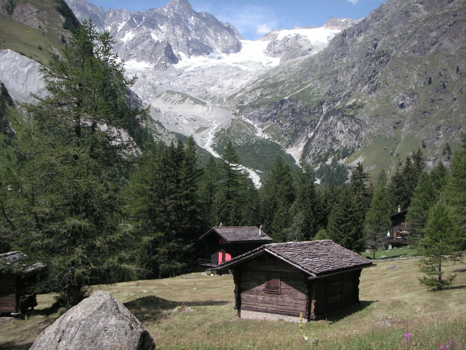
Day 2 | This first day is not demanding and is a nice way to break you in for the days ahead. It can be busy as it shares the same paths as the Tour de Mont Blanc. The route passes though woodland to reach the village of Le Tour after about a 90 minutes. Above Le Tour you climb steadily up open ground below the ski lifts that lead up to the Col de Balme (2204m) - a great viewpoint back to Mont Blanc. A series of sweeping zigzags lead down to the village of Le Peuty and on to Trient. 12km, +953m, -925m, 6 hours walking. |
Day 3 | A classic mountain day and one of the most demanding on the whole route. You ascend the valley, heading directly for the ice cliffs of the Trient Glacier. You climb up the left bank of this steep-sided valley, high above the glacier to reach the rocky cleft of the Fenetre d’Arpette (2665m). After passing through the fenetre, a different world is entered - rocky rather than icy views greet you as you descend into the woodlands and meadows of the Arpette valley and on to the delightful Swiss village of Champex. 14km, 1386m, -1200m, 7 hours walking. |
Day 4 | An easy day, mostly downhill that takes you through 'real, rural Switzerland' as you pass small villages and farms along the way. The 'TMB' crowds have left you so you can enjoy more solitude hopefully. There is no rush to arrive at Le Chable early, so it is best to amble, soak up the scenery and enjoy a few cafe stops! 13km, +750m, -100m, 4 hours walking. |
Day 5 | It's uphill all the way today so an early start is on the cards. Despite passing through the famous ski fields of Verbier, a fine walking route does exist that takes you through shady woodlands, villages and past many good viewpoints. Enjoy the Cabane de Mont Fort, the views to Mont Blanc and the Grand Combin and magnificent sunsets.9km, +1635m, 6.5 hours walking. |
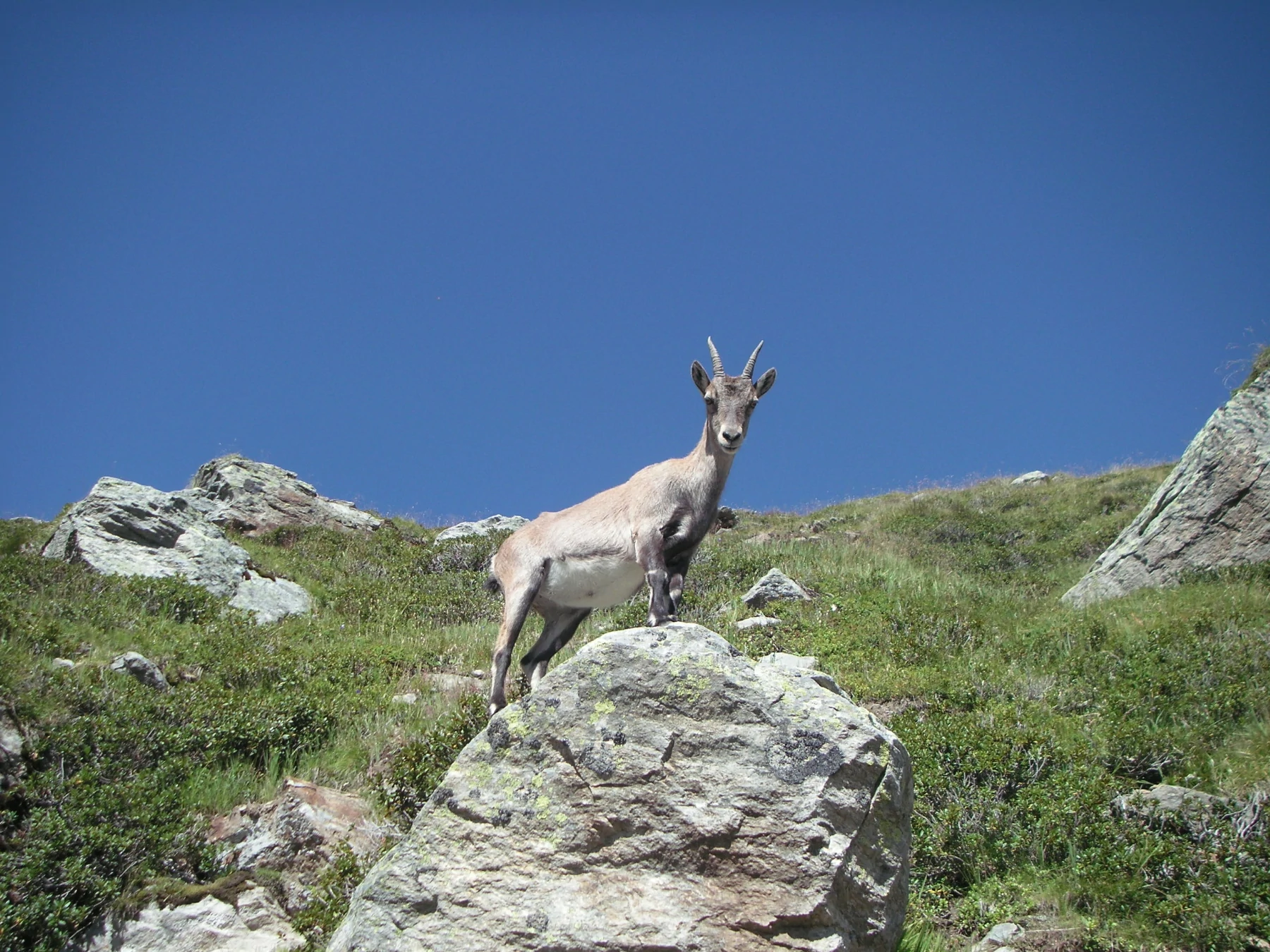
Day 6 | This is a high mountain day that takes you across three passes and can be a serious undertaking in poor weather. If the weather is kind it is magnificent - if poor, a battle of will power! A 'balcon' traverses round to the Col de Termin (2648m) and the Col de Louvie (2921m) where there is a good chance of encountering Ibex. Now you descend to pass below the receding Grand Desert Glacier (the route used to cross it) and up to the final pass, the Col de Plafeluri (2965m). A final steep descent takes you to the refuge. 14km, +885m, -740m, 6.5 hours walking. |
Day 7 | It is only a short climb up to the Col des Roux where you will emerge into the sunshine and be greeted with views down into the Val des Dix and Mont Blanc de Cheilon at the head of the valley. You descend into this valley and, after a pleasant stroll, along the shores of the Lac des Dix. Some challenging terrain is crossed before you reach the Col de Riedmatten (2919m), from where you descend into Arolla. 16km, +735m, -1355m, 6.5 hours walking. |
Day 8 | An easy stage that takes you through delightful woodland via Lac Bleu. Ascent and descent is minor compared to the previous days, but there are some tricky sections protected by chains. You pass some charming old houses around Les Hauderes shortly before arriving at La Sage. 10km, +215m, -554m, 4 hours walking. |
Day 9 | Today's walk is not too long, but does involve a long ascent and some steep ground on either side of the Col du Tsate (2868m) which is crossed to reach the lovely Val de Moiry. There is a welcome resting spot once down in this tranquil valley, with the icy cliffs of the Glacier de Moiry towering above and the refuge visible above its right bank. The refuge, said to be the finest place to stay for its location on the entire route, is reached via a series of zig zags. 10km, +1615m, -460m, 5.5 hours walking. |
Day 10 | A morning to savour! After descending across rough moraine below the refuge, a fine 'belvedere' path contours high above the valley and the Lac du Moriy below. A straightforward ascent leads to the Col de Sorebois (2847m) from where you are greeted with views to the Weisshorn and Zinalrothorn. Zinal village is just below, but it is a 1200m knee-jarring descent through forest to get there. 14km, +460m, -1610m, 5.5 hours walking. |
Day 11 | Another fine day's walk today, starting off on gently rising trails passing isolated old farmsteads along the way. The Col de Forcletta (2874m) is reached via sweeping zig zags. On the other side you descend into the Turtmanntal Valley and to the village of Gruben. This is the first German speaking village you will encounter and is only inhabited in the summer months. 14km, +1200m, -1050m, 6 hours walking. |
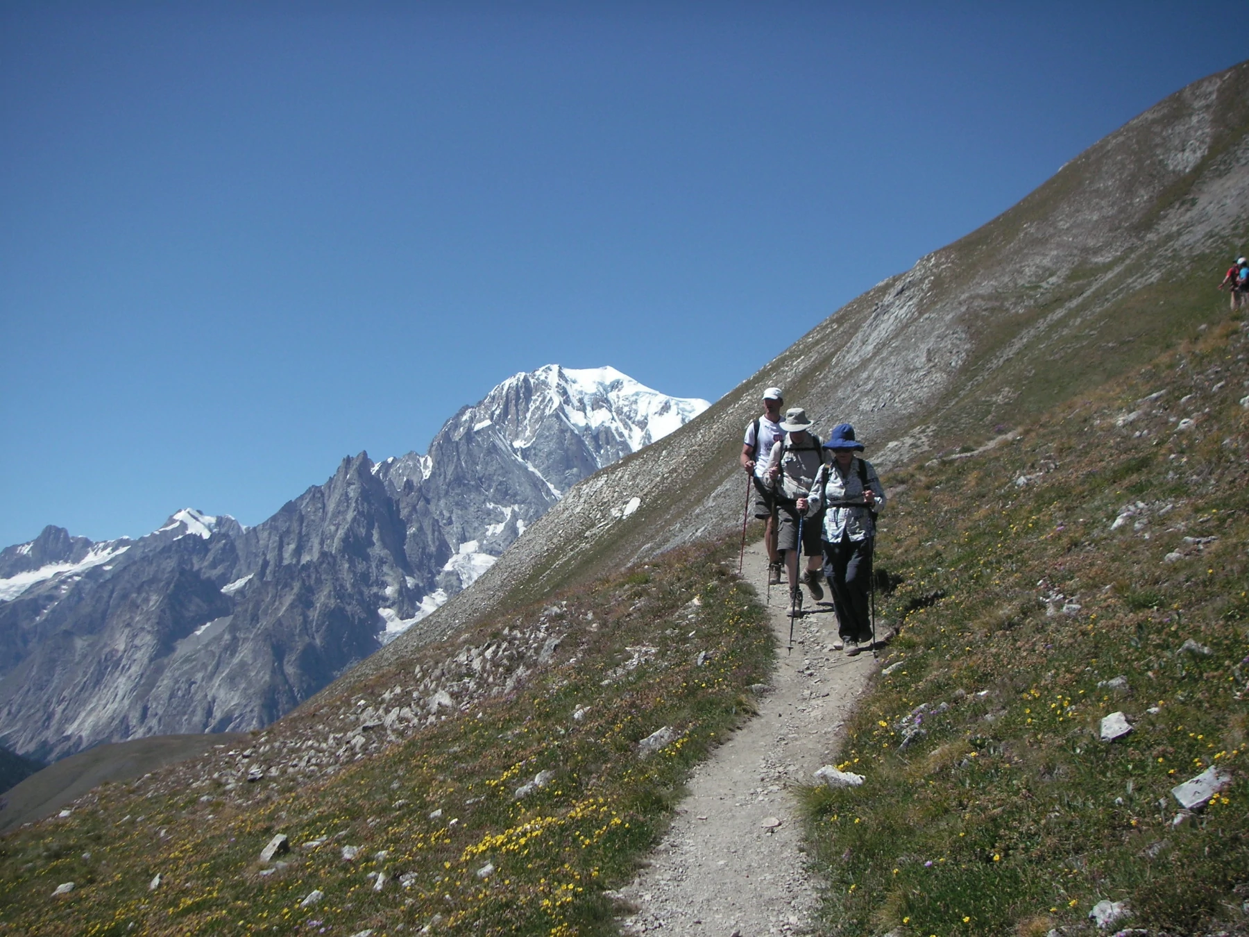
Day 12 | Today takes you over the final pass of the Haute Route through contrasting terrain and scenery as you go. You ascend through woods, pastures and ultimately across rocky ground to gain the Augstbordpass (2894m), a crossing on the old trade route between the Rhone Valley and Italy. Some of the finest views of the route greet you here and remain with you as you descend below the Steitalhorn ridge and round the spur before dropping into the idyllic hamlet of Jungen. A final descent through forest takes you to St.Niklaus. 16km, +1070m, -1770m, 7 hours walking.. |
Day 13 | This final stage of the original Haute Route follows the valley, passing through may interesting villages along the way. It is the original way to reach Zermatt, avoiding the notoriously dangerous Europaweg; a 2-day man-made route that slices across unstable ground high above on the east side of the valley. It is also a bit of a cheeky route, as it keeps the first views of the Matterhorn until right at the very end! 18km, +480m, 4.5 hours walking. |
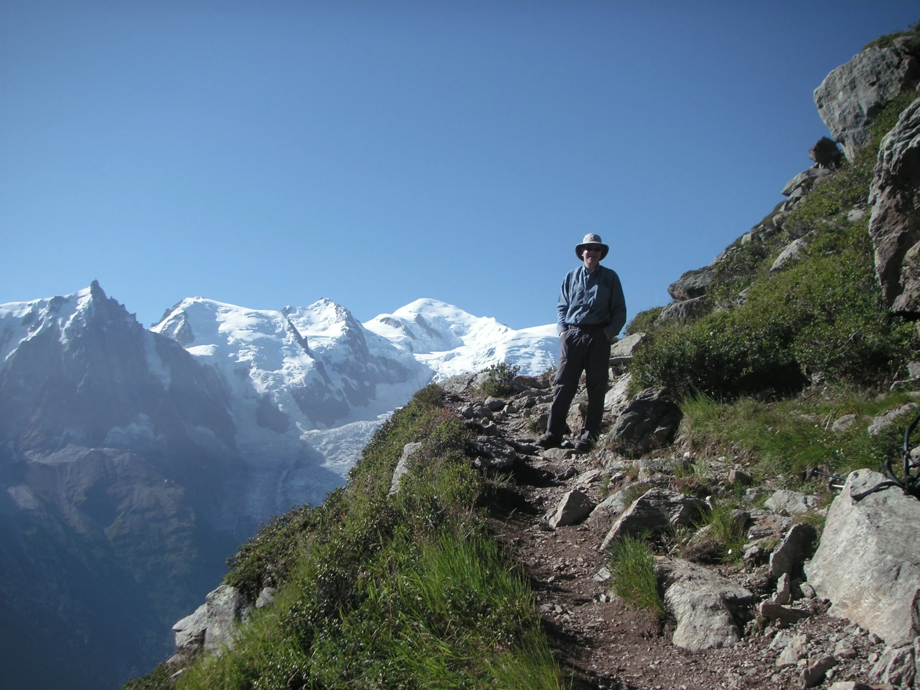
Day 14 | Morning to enjoy Car-free Zermatt with its superb setting below the Matterhorn. OR an early start to make the ascent of the Breithorn. The Breithorn (4,164 m), with its many summits, is a strong, glaciered mountain crest. The normal climb is considered as one of the easiest routes for climbing a four-thousand metre mountain. Travel to Geneva or Zurich to fly home. |
Insurance
It is essential for a trip of this type that you are adequately insured. When researching insurance options, please ensure the policy covers you for the following:
- Cancellation or curtailment
- Helicopter rescue (most insurance companies will no longer cover for ‘search and rescue’ but providing you stay with the group, they will assist with ‘rescue’)
- Repatriation
- The altitude that you are expected to attain
- The location especially when travelling to Antarctica
- Grade of trek/climb/expedition
- Medical cover
We are aware the following provide insurance:
For UK based clients:
Treks under 7000m - Campbell Irvine Direct : http://www.campbellirvine.com/AdventurePeaks Tel: 0207 938 1734
For Trekking Peaks under 7000m (such as Mera & Island Peak) ensure to contact them directly prior to purchasing a policy, including your trip itinerary to ensure your trip is covered
True Traveller Ins: www.truetraveller.com Tel: 020 3822 0200 for treks, some Nepali trekking peaks and low technicality higher peaks like Peak Lenin or Aconcagua
The B.M.C.: www.thebmc.co.uk Tel: 0161 445 6111
World Trips: www.worldtrips.com Tel: 1-800-605-2282
Travelex Ins. Services: www.travelexinsurance.com Tel: 1-800 228 9792
Austrian Alpine Club (UK) https://www.alpenverein.at/britannia/ Tel: +44 (0)1929 556870
Rothwell & Towler: www.world-first.co.uk Tel: 0345 908 0161 (under 6400m)
J S Insurance: www.jsinsurance.co.uk Tel: 0800 043 0020
Snowcard: www.snowcard.co.uk (Online Only)
Dogtag: www.dogtag.co.uk Tel: 0333 005 1085 (Check excess etc)
For non-UK based clients:
World Trips: www.worldtrips.com Tel: 1-800-605-2282
Travelex Ins. Services: www.travelexinsurance.com Tel: 1-800 228 9792
True Traveller Ins: www.truetraveller.com Tel: 020 3822 0200
Austrian Alpine Club (UK) https://www.alpenverein.at/britannia/ Tel: +44 (0)1929 556870
AXA Worldwide Travel Ins: www.axainsurance.com Tel: (0) 330 678 3394
Ingle International: www.ingleinternational.com Tel: (USA) +1 833-362-0692
Insure for Less: www.insure4less.com.au (Australian clients) Tel: +61 (0) 2 9312 5168
Insurance for Technical Peaks and High/Extreme altitude (7000m+) – you will find obtaining insurance for these peaks quite difficult, however Global Rescue is used by many clients and our expedition leaders
 Adventure Peaks partners with Global Rescue to offer the world’s leading travel protection services. Medical and security emergencies happen. When they do, we rely on Global Rescue to provide our clients with medical, security, travel risk and crisis response services. Without a membership, an emergency evacuation could cost over $100,000. More than one million members trust Global Rescue to get them home safely when the unexpected happens:
https://partner.globalrescue.com/adventurepeaks/
You do not have to use any of the above, but if you make your own insurance arrangements documentary evidence of your own policy is required.
Please forward the details of your Insurance as soon as you have it: we need the insurance company’s name, their 24 hour emergency telephone number and your insurance policy number – info@adventurepeaks.com
You may also like:
9 Mountain Days
15 Days